CoCoRaHS Station: MN-HN-22
Date Taken: 9/5/16
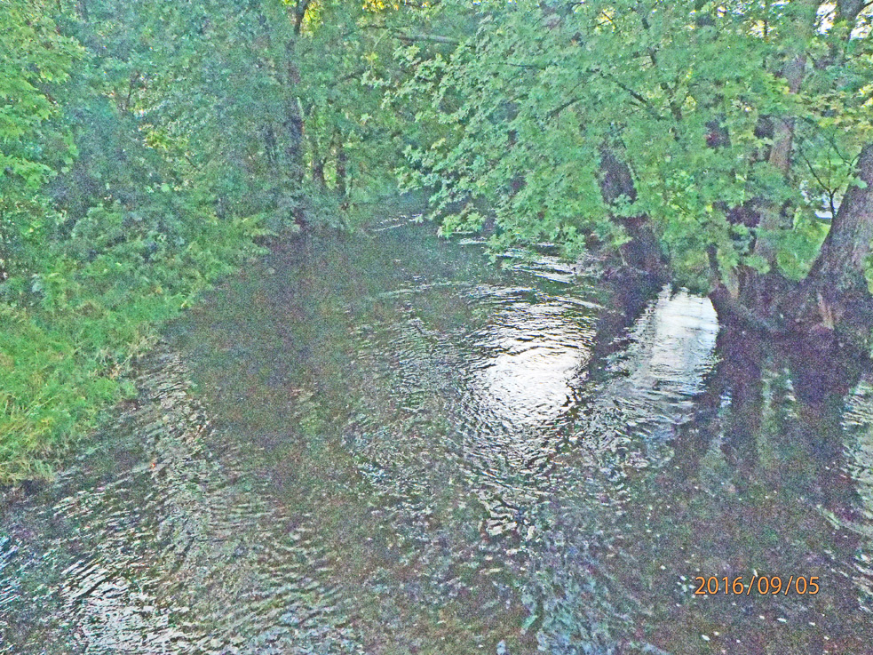
The photos are taken from a footbridge across Minnehaha Creek, in parkland. Minnehaha Creek is an excellent indicator of the drought or water-surplus situation here. In deep drought, the section of creek photographed is dry with puddles here and there. In extreme water-surplus, the parkland next to the creek goes under water. Today, Monday, Labor Day, 5 September 2016, the creek is overfull - the bases of trees next to the creek, normally dry, are in the creek-flow. However, another 2 to 4 feet of creek rise are required to put the adjacent park-land under water, though there is a little standing water on the park land, and the paved walking path (high water table indicator).
Looking "East" photo (actually SE). Note the bases of the trees at right are submerged - this indicates high water flow, especially for Minneapolis on 5 September, when we're normally experiencing the effects of the typical July-August dry season. You are looking downstream along Minnehaha Creek, Minneapolis,MN. Relatively low light level resulted in the grainy appearance of this photo
#CoCoRaHsSep16