CoCoRaHS Station: MN-HN-22
Date Taken: 9/5/14
The photos are taken from a footbridge across Minnehaha Creek, in parkland. Minnehaha Creek is an excellent indicator of the drought or water-surplus situation here. In deep drought, the section of creek photographed is dry with puddles here and there. In extreme water-surplus, the parkland next to the creek goes under water. Today, Monday, Labor Day, 5 September 2016, the creek is overfull - the bases of trees next to the creek, normally dry, are in the creek-flow. However, another 2 to 4 feet of creek rise are required to put the adjacent park-land under water, though there is a little standing water on the park land, and the paved walking path (high water table indicator).
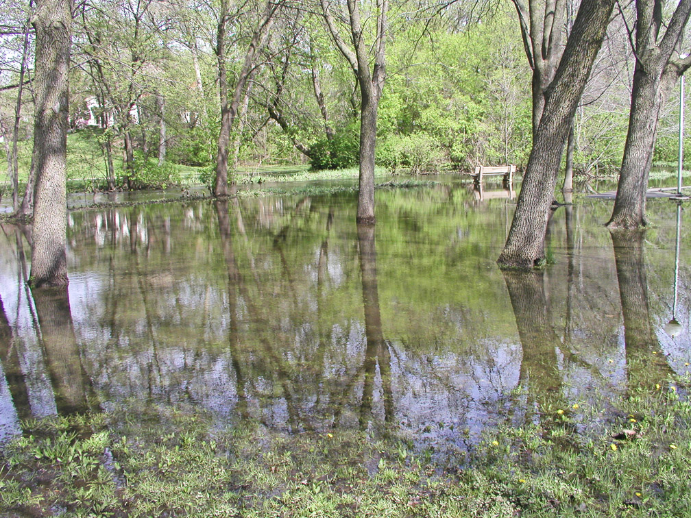
FOR COMPARISON Here is an end-of-JUNE 2014 photos (TWO YEARS AGO + TWO MONTHS)
showing Minnehaha Creek in extreme high water condition taken from a location within 1,000 feet of the above photo (don't know exact locations by GPS).
Note the park bench along the Minnehaha Creek - its base is normally something like 3 to 5 feet above the creek water surface.
The 4 closest large trees in the foreground are on park-land - they are NOT along the creek shore - that shore line is just past the bench.
A smidge of the paved walking path is visible next to the light pole on far right; the rest of the path is submerged.
#CoCoRaHsSep16